
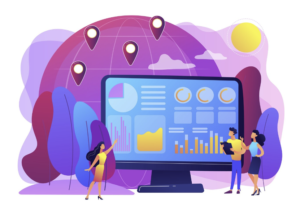
In today’s data-driven world, the integration of geospatial data into analytics has become a cornerstone for businesses seeking to leverage comprehensive insights and make informed decisions. This article delves deeply into the multifaceted benefits of utilizing geospatial data in analytics, highlighting its significance, applications, and the transformative impact it can have on various industries.
Understanding Geospatial Data
Geospatial data refers to information that describes objects, events, or other features on the Earth’s surface. It is typically represented by coordinates and can include various attributes such as location, shape, and size. This type of data is collected through different means, including satellite imagery, GPS, and remote sensors, and is used in combination with geographic information systems (GIS) to analyze spatial relationships and patterns.
Enhanced Decision-Making with Geospatial Data
Integrating geospatial data into analytics provides businesses with a holistic view of their operations. By visualizing data on maps, organizations can uncover patterns and correlations that are not evident in traditional datasets. This spatial perspective enhances decision-making by:
- Identifying Trends and Patterns: Geospatial analytics helps in identifying spatial patterns, such as customer distribution, resource allocation, and market trends. This insight is crucial for strategic planning and resource management.
- Optimizing Supply Chain Operations: Businesses can use geospatial data to optimize their supply chain logistics. By analyzing the geographic distribution of suppliers, warehouses, and customers, companies can streamline their operations, reduce costs, and improve delivery times.
- Risk Management: Geospatial data is invaluable in risk assessment and management. It aids in identifying areas prone to natural disasters, crime hotspots, and other potential risks, enabling businesses to develop effective mitigation strategies.
Improving Customer Insights and Marketing Strategies
Geospatial data offers profound insights into customer behavior and preferences, allowing businesses to tailor their marketing strategies more effectively. Key benefits include:
- Targeted Marketing Campaigns: By understanding the geographic distribution of their customer base, companies can design targeted marketing campaigns that resonate with specific regional audiences, thereby increasing engagement and conversion rates.
- Market Segmentation: Geospatial data enables precise market segmentation based on location-based characteristics. This allows businesses to identify underserved markets and tailor their products or services to meet the unique needs of different regions.
- Enhancing Customer Experience: Companies can use geospatial analytics to enhance the customer experience by optimizing the locations of retail stores, service centers, and distribution points, ensuring they are easily accessible to their target audience.
Also Read: Unveiling the Latest India Consumer Trends
Driving Innovation in Various Industries
The application of geospatial data extends across multiple industries, driving innovation and operational efficiency. Here are some key examples:
Healthcare
In the healthcare sector, geospatial data is used to improve public health surveillance, resource allocation, and service delivery. For instance:
- Disease Tracking and Prevention: Geospatial analytics helps in tracking the spread of diseases, identifying hotspots, and planning preventive measures. This is particularly vital during outbreaks of infectious diseases.
- Resource Optimization: By analyzing the geographic distribution of healthcare facilities and population density, healthcare providers can optimize the placement of new facilities and allocate resources more effectively.
Retail
Retailers leverage geospatial data to enhance their market presence and operational efficiency:
- Site Selection: Geospatial analytics assists in selecting optimal locations for new stores based on factors like population density, competitor presence, and accessibility.
- Inventory Management: Retailers can use location data to manage inventory more efficiently, ensuring that products are available where they are most needed, reducing stockouts and overstock situations.
Real Estate
In real estate, geospatial data is crucial for property valuation, site analysis, and market trends analysis:
- Property Valuation: Geospatial analytics provides detailed insights into property values based on location, proximity to amenities, and historical trends.
- Site Analysis: Developers use geospatial data to analyze potential sites for development, considering factors like land use, environmental impact, and accessibility.
Transportation and Logistics
The transportation and logistics industry benefits immensely from geospatial data through:
- Route Optimization: Geospatial analytics enables the optimization of delivery routes, reducing fuel consumption, and improving delivery times.
- Fleet Management: Companies can monitor and manage their fleets more effectively by tracking vehicle locations, optimizing maintenance schedules, and improving overall fleet efficiency.
Advancing Environmental and Sustainability Goals
Geospatial data plays a pivotal role in environmental monitoring and promoting sustainability. Key applications include:
- Environmental Monitoring: By analyzing satellite imagery and other geospatial data, organizations can monitor changes in land use, deforestation, and other environmental indicators, enabling proactive measures to protect ecosystems.
- Resource Management: Geospatial analytics helps in managing natural resources more efficiently, ensuring sustainable use of water, minerals, and other vital resources.
- Urban Planning: Urban planners use geospatial data to design sustainable cities, optimize land use, and ensure the efficient provision of services and infrastructure.
Enhancing Emergency Response and Public Safety
In emergency response and public safety, geospatial data is indispensable for:
- Disaster Response: Geospatial analytics aids in disaster response by providing real-time data on affected areas, enabling swift and effective relief operations.
- Public Safety: Law enforcement agencies use geospatial data to identify crime hotspots, plan patrol routes, and allocate resources to enhance public safety.
Also Read: Understanding Consumer Behavior Trends in 2024
Conclusion
The integration of geospatial data into analytics offers a multitude of benefits across various sectors, enhancing decision-making, improving customer insights, driving innovation, and advancing sustainability goals. By leveraging the power of geospatial data, organizations can gain a competitive edge, optimize their operations, and contribute to a more sustainable future